Key take away: They’re assessing structure protection needs in Walker and Potato Patch today.
Last night firefighters benefited from lower temperatures and higher relative humidity which reduced fire intensity. Fire is backing down slope in the ponderosa pine on the north side of Big Bug Mesa and had little activity in the brush. The fire did cross the 58 Road along Big Bug Creek.
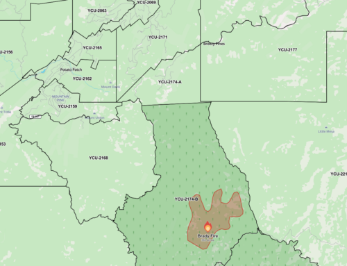
The north side of the fire continues to be the most active area for firefighters. Crews will be assessing structure protection needs in Walker and Potato Patch today as well as continuing efforts in Breezy Pines. Tactical options are being developed on the north side of the fire. The anticipation of favorable weather conditions today will allow firefighters to make progress in several areas around the perimeter.
https://inciweb.nwcg.gov/incident/article/5278/35931/
Incident: Goodwin Fire Wildfire
Released: 44 min. agoGoodwin Fire
June 29, 2017, 9:00 a.m.
Location: Bradshaw Ranger District, of Prescott National Forest; 14 miles south of Prescott, AZ (T12N R1W, S28)
Start date: June 24, 2017, 4:00 p.m.
Size: Approximately 24,828 acres
Percent Contained: 1%
Cause: Under Investigation
Resources Assigned: Approximately 800 personnel
Vegetation: Predominantly dense chaparral and Ponderosa pine stands in drainages.
A Public Meeting will be held today, Thursday, June 29 at 6 p.m. at the Lifepointe Church, 10100 AZ highway 69, Prescott Valley.
The evacuation for the community of Mayer will be lifted as of 10:00am Thursday, June 29th. Please note there are significant road closures still in place.
Access to the community of Mayer will ONLY be from the south. SR69 will be open from I-17 north to Central Avenue in Mayer. SR69 will be closed at Central Avenue to all traffic heading north. To the north, the other closure point for SR69 remains in effect at the intersection of SR169 and SR69. No southbound traffic will be allowed on SR69 south of SR169. The High Chaparral community and Poland Junction, both east and west of SR69, are still under full evacuation.
To access Mayer from the north side of the closure, the community is advised that they should take SR69 south to SR169, SR169 east to I-17, I-17 south to SR-69, and then SR69 north into Mayer.
The closure for SR69 remains necessary as firefighters will be completing burnout operations along the roadway north of Poland Junction. These actions are required to create a fire break to help protect the communities to the north.
The following communities remain under mandatory evacuation: Pine Flat, Breezy Pines, Poland Junction, Chauncey Ranch Rd., Mt. Union, Walker, Upper Blue Hills, Potato Patch, Dewey west of SR69, and Mountain Pine Acres.
All cooperating partners involved in the closure and firefighting operations wish to thank the community for their patience and understanding. They realize the inconvenience created by evacuations and are working diligently to open communities as soon as safely possible.
DRONE INTRUSION OVER THE FIRE: Aircraft are one of the primary tools being used for fighting this fire including structure protection. Yesterday air operations were shut down due to the intrusion of an unmanned aircraft system (UAS) or “drone” in the airspace associated with the fire causing the immediate grounding of all firefighting aircraft and potentially endangering the lives of the firefighters while limiting their ability to protect the community. There is a Temporary Flight Restriction (TFR) over the fire area and it is illegal to fly a drone within the restricted area. Violators will be prosecuted to the fullest extent of the law. To maintain a safe environment for the aircraft, pilots, and ground crews, it is imperative that the air be clear of other craft, including UAS. The community is reminded that “if you fly, we can’t fly.”
Summary:
The Incident Management Team and all of the Agency Cooperators are keenly aware of the tremendous impacts to the community from the closures associated with the fire. These closures are essential to provide for both public and firefighter safety in the midst of the many moving parts associated with fighting this fire.
Last night firefighters benefited from lower temperatures and higher relative humidity which reduced fire intensity. Fire is backing down slope in the ponderosa pine on the north side of Big Bug Mesa and had little activity in the brush. The fire did cross the 58 Road along Big Bug Creek.
The north side of the fire continues to be the most active area for firefighters. Crews will be assessing structure protection needs in Walker and Potato Patch today as well as continuing efforts in Breezy Pines. Tactical options are being developed on the north side of the fire. The anticipation of favorable weather conditions today will allow firefighters to make progress in several areas around the perimeter.
People wanting to make donations can contact either Tony Figlerski with the American Red Cross at (928) 814-4999 or Lt. Miner with the Salvation Army at (623) 910-1501 or Lt. Elaine Mansoor at (928) 778-0150.
Evacuations:
· Walker, Blue Hills, Mountain Pine Acres, Dewey west of Hwy 69 excluding Prescott Country Club, Chauncey Ranch Road, Mt. Union
· the area west of Highway 69, from Mayer to Poland Junction.
· Poland Junction, Chaparral Hills and the Breezy Pines subdivision, Blue Hills, and Potato Patch
· The evacuation remains in place for Pine Flat
A shelter has been set up at the Bradshaw Mountain High School, 6000 E Long Look Drive in Prescott Valley off of Glassford Hill Rd.
Pre-Evacuation:
A Pre-evacuation is in effect for Orme School.
For additional information regarding evacuations and pre-evacuations please call the Yavapai County Emergency Operation Center at (928) 442-5103, 7am – 7pm.
Closures:
· State Highway 69 is closed from Central Avenue in Mayer north to the Hwy 169 Junction.
· The Bradshaw Ranger District has expanded the Goodwin Fire area closure on Wednesday, June 28th at 6:00 am. The area affected follows the Prescott NF boundary along State Hwy 69 on the East and North sides, then State Highway 89 on the West, and as far south as Walnut Grove across to Cleator. All campgrounds and recreation opportunities in this area will be closed to the public as a precautionary measure to ensure public safety and to allow safe travel for those involved in the Goodwin Fire. Please visit the Prescott National Forest website (www.fs.fed.us/r3/prescott) or Inciweb (https://inciweb.nwcg.gov/incident/5278/) for a map of the closed area.Debbie Maneely
Public Affairs/FOIAForest Service
Prescott National Forest
p: 928-443-8130
c: 928-499-4736
dmaneely@fs.fed.us2971 Willow Creek Road, BLDG 4
Prescott, AZ 86301
www.fs.fed.us


Leave A Comment